Fathom Science’s Ocean Analysis for Hurricane Isaias gives you multi-layered information on the hurricane’s impacts on ocean and atmospheric conditions. A hurricane is as much an ocean event as it is an atmospheric event, with conditions in the ocean impacting hurricane intensity and track. Use the layer feature in the top right corner to change the display to sea surface temperature, sea surface salinity, sea surface height, significant wave height, wave direction, GOES satellite visible imagery, and rain bands. Watch conditions evolve for yesterday, today, and tomorrow with the time slider.
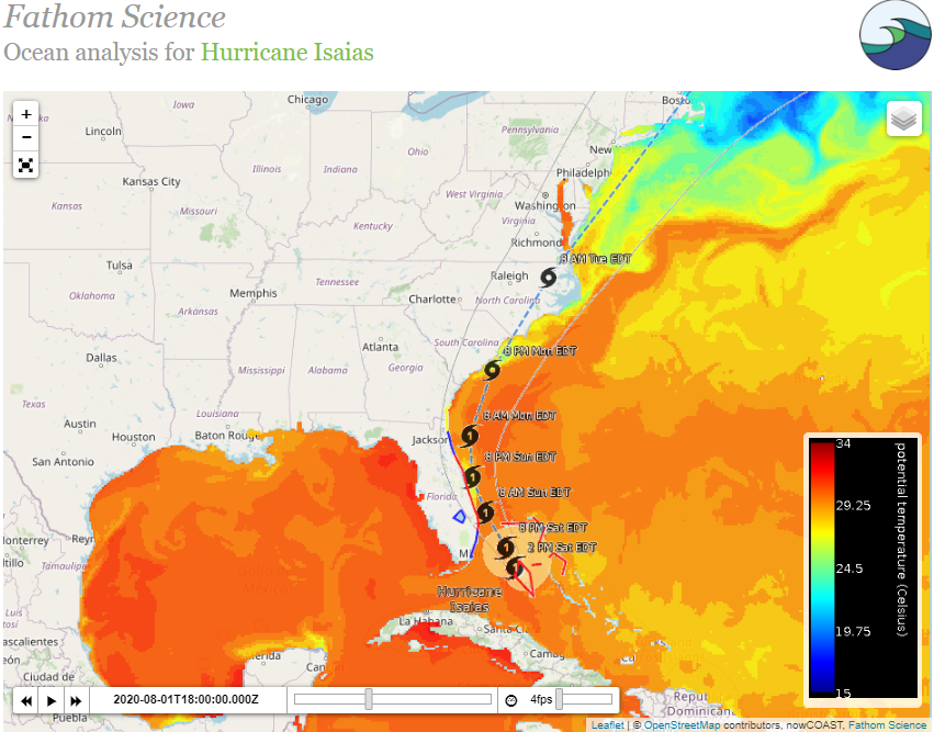
Hurricanes affect and are affected by ocean conditions. Hurricanes change the circulation of the ocean they pass through, causing upwelling of cold, nutrient-rich water in the right-side wake of the storm. Look for this effect (with a day or two lag) in the Sea Surface Temperature layer.
Hurricane strength can increase when it passes over warm water, and likewise decrease over cool water. Look ahead in the Sea Surface Temperature layer to see what’s coming for the hurricane.
The Significant Wave Heigh layer shows how the storm’s winds affect the ocean hundreds of kilometers ahead of the center.
Learn about the impacts of hurricanes in real time, keep informed, and stay safe!